


Product Details
+
Please call 770-695-3361 for your custom quote. Or start your 14-day free trial - Call us today!
3Dsurvey Photogrammetry Software for Surveying
3Dsurvey is the complete digital suite for survey-grade mapping and image processing. Transform your imagery data into highly accurate digital maps, 3D models, and interactive measurements with extreme cm-grade precision.
- Best-in-class point cloud customization tool enabling you fast, user-friendly and simple data classification
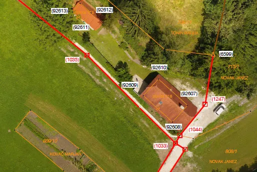
- Generate a fully geo-referenced, spatially orientated, and complete overview of your site configuration
- Calculate high-resolution digital orthophotos with cm-grade precision in perfect geo-referenced detail for further land surveying and mapping exploration
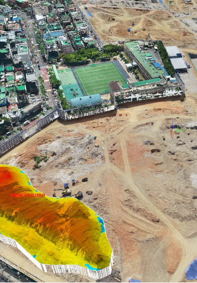
- Explore volumetric calculations with great speed and accuracy
- Calculate single vertical cross-sections or multiple transverse profiles
- Integrated CAD environment enables you to finish your projects without any specialized third-party software
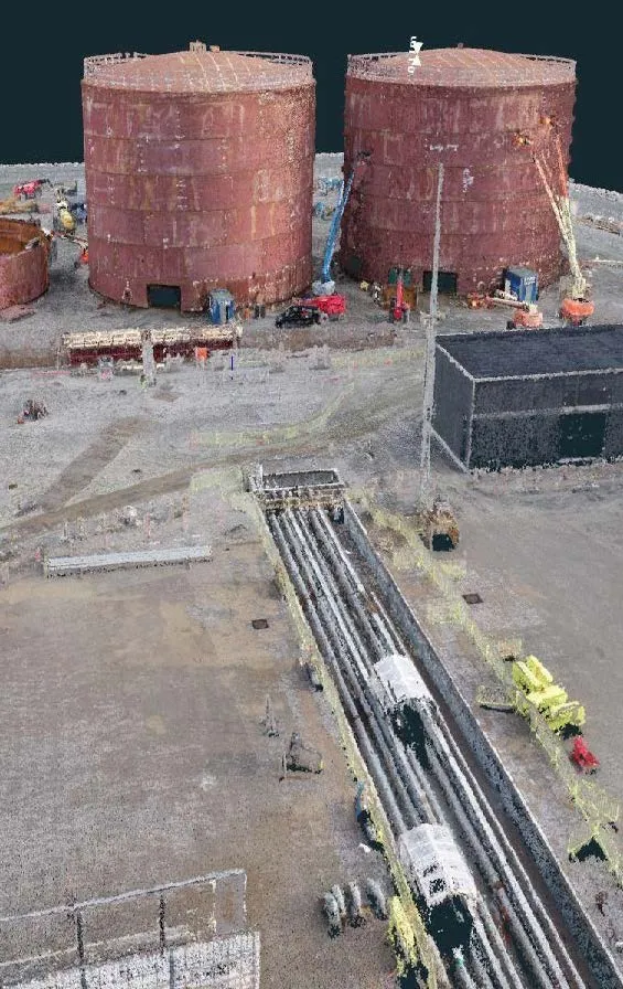
- Create extremely dense 3D point clouds
- Interactively measure slope, elevation, size, or distance in 2D or 3D
- Explore terrain elevation data in 2D or 3D by leveraging 3Dsurvey's automated contour lines calculation
- Import, process, and share both terrestrial and aerial data, acquired by any type of camera
- Export your work to Google Earth, CAD, or any other third-party software
Additional Resources


 Cotton Animals Print 0 m Age, Orange")
![Ikaria Walking Map [10.51]](https://www.venturetrall.shop/image/ikaria-walking-map-1051_V2dkgd_300x.webp "Ikaria Walking Map [10.51]")

